Kyrgyzstan is already known as one of Central Asia’s great trekking destinations, but the famous Ala-Kul circuit only hints at what lies deeper in the mountains.
Push beyond the busiest trails and the Tien Shan opens into enormous valleys, glacial basins, high summer pastures, and borderlands where roads disappear and self-sufficiency starts to matter.
Advanced trekking across Kyrgyzstan’s remote Tien Shan valleys is less about ticking off a famous summit and more about linking landscapes.
A serious route might begin in Jyrgalan, cross several passes above 3,500 meters, descend into isolated grazing valleys, and continue toward Ala-Kul or Jeti-Oguz days later.
Kyrgyzstan’s tourism authorities describe trekking options ranging from easy walks to multi-day journeys using tents and yurts, while some of the country’s more remote border regions require additional permits.
For experienced hikers, that combination of altitude, remoteness, pastoral culture, and flexible route design is exactly what makes the Tien Shan special.
Start With the Ak-Suu Traverse, Not Just Ala-Kul
Ala-Kul is beautiful, but experienced hikers should consider treating it as one stage of a much longer route.
The Ak-Suu Traverse is a better example of what serious Tien Shan trekking can feel like. Current Visit Kyrgyzstan itineraries run for seven to nine days and link valleys around Jyrgalan, Boz-Uchuk, Jergez, Almaluu, Altyn Arashan, Ala-Kul, Karakol Gorge, and Jeti-Oguz.
This changes the character of the trip completely.
Instead of climbing to one lake and descending, you spend consecutive days crossing passes such as Boz-Uchuk, Ailanysh, Ortok, Ala-Kul, and Telety. The seven-day version covers roughly 93 kilometers and reaches about 3,906 meters at the Ala-Kul North Pass.
The harder part is not any single day. It is recovering well enough to repeat six or seven demanding days in a row.
That is why fitness, pack weight, food planning, and good preperation matter more here than on a short overnight trek.
Use Jyrgalan as a Gateway to Quieter Valleys
Karakol remains the main trekking hub in eastern Kyrgyzstan, but Jyrgalan provides a quieter doorway into the Terskey Ala-Too.
The longer Ak-Suu Traverse begins with a transfer from Karakol to Jyrgalan before moving into the Terim-Tor area and onward toward Boz-Uchuk. Current official tourism itineraries place early camps around 3,200 meters, with multiple passes arriving almost immediately afterward.
That makes Jyrgalan useful for trekkers who want to leave the classic Karakol Gorge-Ala-Kul corridor behind.
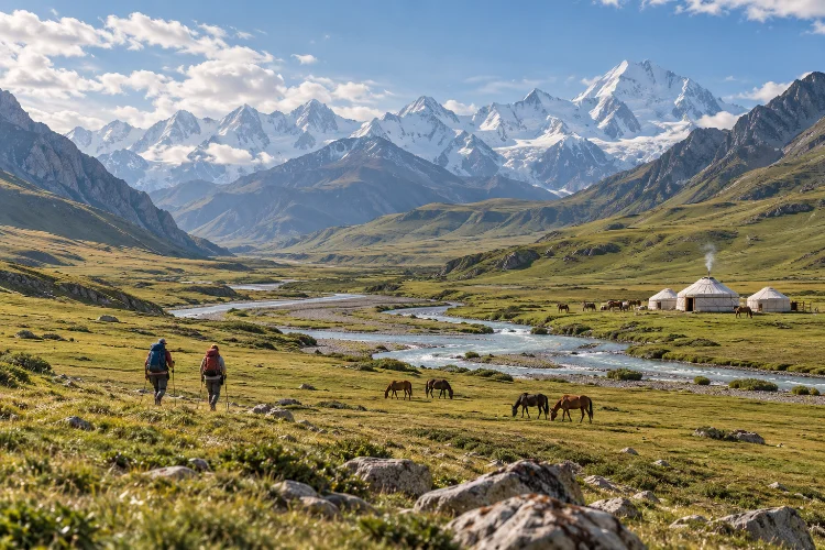
The terrain is a mixture of broad jailoo pastures, river valleys, alpine lakes, scree passes, and glaciated mountain walls. In summer, yurts may appear in some grazing areas, but hikers should not assume that food or shelter will be available everywhere.
Carry enough capacity to camp independently.
Remote trekking becomes much more enjoyable when a yurt stay feels like a bonus rather than something your survival plan depends on.
Push Toward Sary-Jaz and the Central Tien Shan
For a much greater sense of isolation, look east toward the Sary-Jaz region.
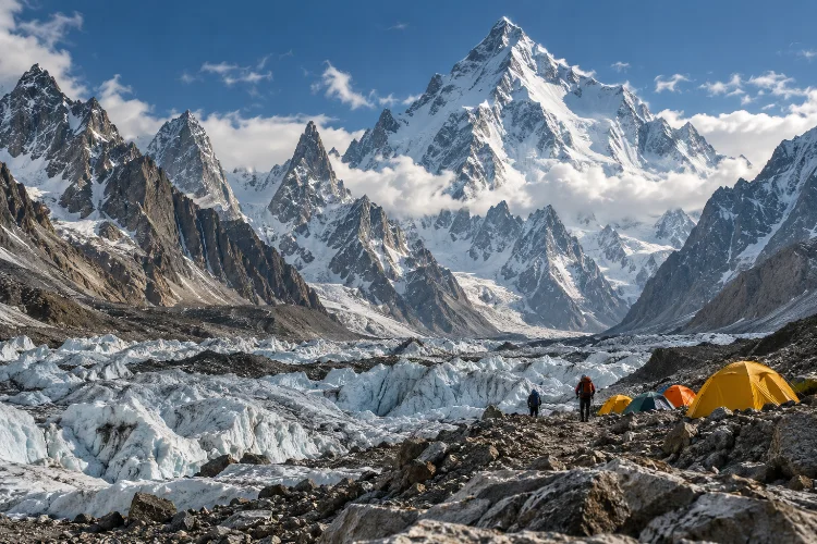
This is the landscape approaching the central Tien Shan, including areas associated with the Enilchek Glacier and the massive peaks near the Chinese border. It feels very different from the comparatively accessible valleys around Karakol.
The main complication is administrative.
Visit Kyrgyzstan currently lists Sary-Jaz Valley, Enilchek Glacier, Khan Tengri Base Camp, and nearby protected areas among destinations where a Border Zone Permit is generally required. Travelers may need to carry the original paper permit alongside their passport at checkpoints.
The same official guidance recommends beginning the permit process roughly three to four weeks before travel, particularly when using an agency to organize access.
This is not a region for a spontaneous “we’ll see where the trail goes” approach.
Routes can involve long vehicle approaches, limited settlements, glacial rivers, uncertain trail visibility, and very little easy evacuation infrastructure.
Explore the Ak-Sai and Kokshaal-Too Borderlands Carefully
The southern and southeastern Tien Shan around Naryn province offers another level of remoteness.
Ak-Sai Valley and areas around Kol-Suu and Chatyr-Kul sit close to international borders and feature vast high-altitude plains framed by harsh mountain ridges. Visit Kyrgyzstan lists Ak-Sai, Kol-Suu, and Chatyr-Kul among locations where border-zone access requirements apply.
Tour itineraries entering this landscape already involve lengthy 4WD transfers across high passes before reaching trekking or yurt areas.
For advanced hikers, the attraction is scale rather than a famous trail.
You may spend hours crossing open valleys where settlements are tiny or nonexistent. Navigation becomes more important because livestock tracks can be easier to find than obvious hiking paths.
Reliable offline maps, backup navigaton, sufficient fuel or food, and clear extraction plans matter here.
This is one of those regions where hiring local support can improve the trip even for highly independent trekkers.
Expect High Passes to Define the Daily Rhythm
The Tien Shan often forces you to think vertically rather than in kilometers.
A 12-kilometer day can be much harder than a 20-kilometer valley walk if it involves 1,000 meters of climbing followed by loose scree on the descent.
The official seven-day Ak-Suu itinerary, for example, includes the 3,650-meter Ortok Pass, roughly 3,906-meter Ala-Kul North Pass, and 3,792-meter Telety Pass across consecutive stages.
That repeated altitude is what turns a beautiful trekking route into an endurance challenge.
Start early. Afternoon cloud and storms can make exposed passes unpleasant or dangerous, while river levels may also change as snow and glacial melt increases later in the day.
Do not build a route assuming every camp must be reached at a particular hour.
In remote mountain trekking, arriving safely at a lower backup camp is usually better than crossing a high pass simply because your spreadsheet says you should.
Treat River Crossings as a Real Route-Planning Issue
Some Kyrgyz valleys have bridges. Others do not.
Remote routes can involve fording streams that look harmless in the morning but become stronger after warm afternoons accelerate snowmelt.
This is one reason local route information matters so much.
Check recent reports, ask guides or shepherds about river conditions, and avoid assuming the crossing shown on an old GPS track still exists in the same form.
When a river looks unsafe, changing plans is not failure.
Advanced trekking is partly the ability to recognize when a route is no longer worth the risk.
Keep sandals or appropriate footwear accessible for easier crossings, protect critical equipment in waterproof bags, and never treat electronics as your only source of navigation.
Wet sleeping gear can turn one poor decision into several miserable days.
Mix Wild Camps With Yurt Stays
One of the pleasures of trekking in Kyrgyzstan is that “remote” does not always mean completely uninhabited.
Summer jailoos bring shepherd families and livestock into high valleys, and some established trekking routes use seasonal yurt camps. Official Ak-Suu itineraries combine yurts, guesthouses, and tents across the same multi-day journey.
This allows a useful hybrid strategy.
Carry camping gear so you remain independent, but use yurts when available for hot meals, warmth, conversation, and a break from pitching a tent.
Do not assume every yurt is commercial accomodation, though.
Many belong to working pastoral families. Ask before entering, respect livestock and dogs, and expect communication to rely on a mixture of Kyrgyz, Russian, gestures, and patience.
These encounters often become as memorable as the mountain passes.
Plan Around the Short High-Mountain Season
For most non-winter trekkers, summer is the practical window.
Visit Kyrgyzstan’s current Ak-Suu routes generally operate from June through September, while some higher or more exposed sections can remain difficult early in the season because of snow.
July and August provide the warmest conditions, but they can also bring thunderstorms and stronger glacial melt.
September often offers quieter trails and crisp visibility, although nights become colder and seasonal camps begin closing.
Whatever month you choose, carry insulation suitable for temperatures near or below freezing.
A valley can feel warm at lunchtime and completely different at a 3,800-meter camp after sunset.
Weather margins should be built into the route rather than added after something goes wrong.
Understand Permits Before Reaching the Trailhead
Kyrgyzstan is famously flexible for trekking, but remote border regions are the exception.
Current tourism guidance states that zones near China, Tajikistan, and Kazakhstan can require special border permits. The list includes major adventure areas such as Sary-Jaz, Enilchek, Ak-Sai, Kol-Suu, and parts of Chong-Kemin.
Protected natural areas can also have their own rules for tourist trails and campsites under Kyrgyz regulations.
Organize this before travel.
A perfect GPX route is useless if a checkpoint prevents you from entering the valley.
Because requirements can change, confirm the latest process shortly before departure rather than relying on an old trekking forum or blog.
For complicated expeditions, a local trekking operator can handle permits, horse support, transfers, and emergency communication while still leaving the hiking itself physically demanding.
Carry for Self-Sufficiency, Not Comfort Alone
Multi-day Tien Shan trekking requires a different packing philosophy from lodge-based routes in Nepal or Japan.
A reliable shelter, warm sleep system, stove, water treatment, repair kit, first-aid supplies, offline maps, and emergency communication deserve priority over luxury items.
Food is another major consideration.
A seven- or nine-day traverse can consume far more calories than expected, especially when repeatedly crossing 3,500-3,900-meter passes. Carry compact foods that you know your body can tolerate at altitude.
Pack weight still matters.
The challenge is finding the point where you are light enough to move efficiently but equipped enough to spend an unexpected extra night out.
That balance is the real skill behind advanced wilderness trekking.
Advanced trekking across Kyrgyzstan’s remote Tien Shan valleys is about much more than reaching Ala-Kul.
The real adventure begins when you link valleys such as Jyrgalan, Boz-Uchuk, Jergez, Ak-Suu, Karakol, and Jeti-Oguz – or move even farther toward the border landscapes of Sary-Jaz, Enilchek, and Ak-Sai.
These routes demand fitness, self-sufficiency, realistic acclimatization, and more careful permit planning than Kyrgyzstan’s easier treks.
Choose a route that leaves room for weather and changing river conditions, carry enough gear to camp independently, and use local knowledge whenever the landscape becomes truly remote.
If the classic Kyrgyz trails have already given you a taste of the Tien Shan, the next step is simple: stop planning around one destination and start thinking in entire valleys.