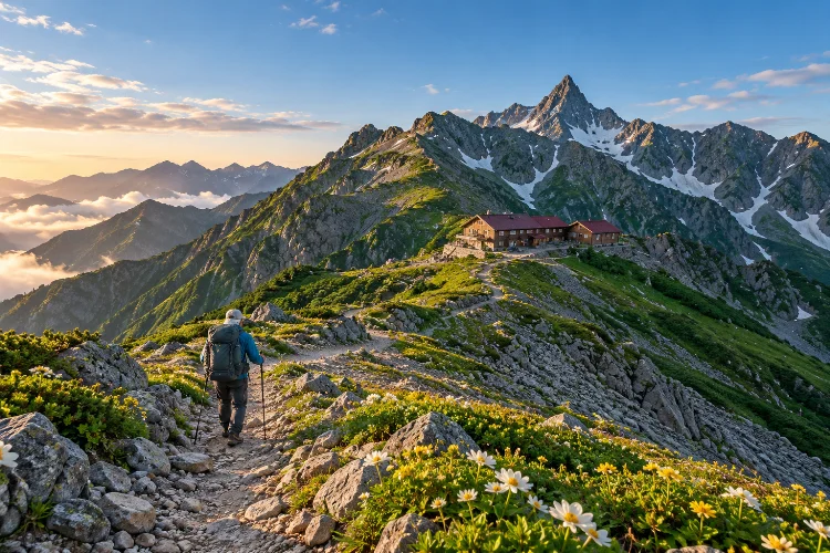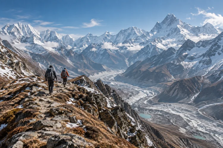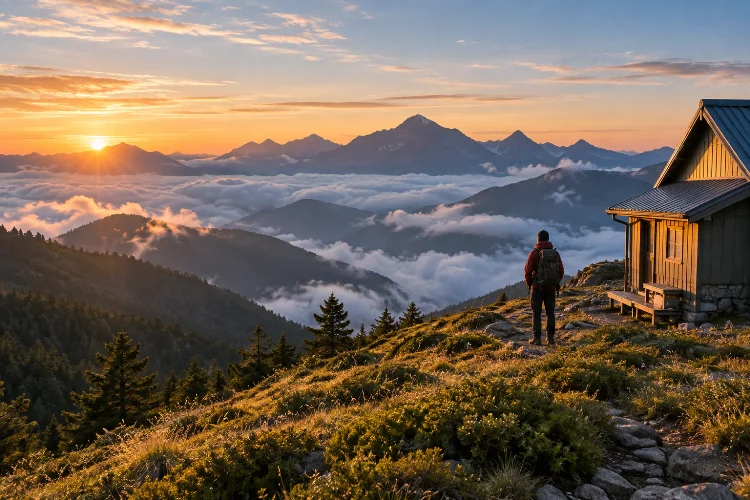
Taiwan is easy to associate with Taipei night markets, coastal railways, and accessible hiking trails just outside major cities.
But look toward the island’s interior and the landscape changes dramatically. Peaks rise close to 4,000 meters, forests transition into alpine vegetation, and some trails require several days of hiking between mountain huts and exposed ridgelines.
Learning how to trek Taiwan’s high mountains beyond popular day hikes means moving from casual hiking into genuine high-altitude mountain travel.
Yushan reaches 3,952 meters, while Xueshan rises to 3,886 meters and anchors a huge alpine region within Shei-Pa National Park.
Farther south and east, Jiaming Lake creates a classic three-day route through high grasslands, while Nanhu Mountain offers a more demanding expedition into Taiwan’s Central Mountain Range.
These journeys require permits, overnight planning, weather awareness, and realistic acclimatization. The reward is seeing a completely different Taiwan – one shaped by ridges, forests, mountain huts, and long days on foot.
Understand Why Taiwan’s High Mountains Are Different
A trail does not have to be technically extreme to become serious once it climbs above 3,000 meters.
Weather can change quickly, temperatures fall sharply after sunset, and high elevation adds physical stress even for hikers who are comfortable walking long distances. Taiwan’s mountain geography also creates steep terrain, erosion zones, exposed ridges, and occasional landslide hazards.
Shei-Pa National Park alone contains 51 peaks above 3,000 meters, with elevation rising to 3,886 meters on Xueshan.
Multi-day hiking therefore requires more than strong legs. Navigation, appropriate insulation, rain protection, adequate food, and the ability to change plans when conditions deteriorate all matter.
Do not treat a mountain hut reservation as proof that the trail is easy. Infrastructure reduces logistical difficulty; it does not remove mountain risk.
Start With a Two-Day Yushan Main Peak Journey
Yushan, also called Jade Mountain, is Taiwan’s highest peak at 3,952 meters and an obvious introduction to high-altitude trekking.
The classic route begins around Tataka and climbs toward Paiyun Lodge, which sits at about 3,402 meters and roughly 8.5 kilometers from the trailhead.
Yushan National Park describes the broader Yushan Peaks trail system as requiring advance permits, while Paiyun Lodge operates with limited capacity.
A common approach is to hike to Paiyun on day one, sleep at altitude, and make an early ascent toward the main summit the following morning before descending.
That format gives hikers their first experience of managing a high-altitude overnight without committing to a week-long expedition.
Still, do not underestimate it. The elevation gain from Tataka is substantial, and symptoms such as headache, dizziness, weakness, or nausea should be treated seriously rather than ignored for the sake of reaching the summit.
Yushan National Park specifically advises descent or stopping an ascent when mountain-sickness symptoms become concerning.
Move Up to Xueshan for a Longer Alpine Experience
Xueshan, or Snow Mountain, is Taiwan’s second-highest mountain at 3,886 meters.
Its landscape changes beautifully with elevation. Trails move through temperate forests, high-elevation fir zones, alpine vegetation, and the glacial cirques associated with the upper mountain.
Shei-Pa National Park describes the famous Black Forest as part of the Taiwan fir ecosystem found in the high Xueshan region.
A multi-day Xueshan itinerary provides a more extended mountain experience than a simple overnight summit push.
Hut and campsite arrangements form an important part of planning. Routes inside ecological conservation areas require the appropriate park procedures, and hikers must use authorized overnight locations rather than simply pitching tents anywhere.
Winter changes the difficulty dramatically. Shei-Pa warns that snow, ice, and freezing conditions can require equipment such as crampons and ice axes as well as genuine winter-mountaineering judgment.
For most non-winter hikers, treating snow season as a seperate discipline is the sensible approach.
Try Jiaming Lake for a Classic Three-Day Route
Jiaming Lake is one of Taiwan’s most appealing introductions to longer ridge walking.
The lake lies at roughly 3,310 meters near Sancha Mountain and is surrounded by broad alpine grasslands. Taiwan’s Forestry and Nature Conservation Agency describes it as the island’s second-highest alpine lake after Xueshan’s Cuei Pond.
The official route is commonly structured across three days.
The first stage climbs through forest toward high mountain accommodation, while the middle day reaches Sancha Mountain and Jiaming Lake before returning toward the hut system.
The final day descends toward the Xiangyang trailhead. The official trail guide lists elevations from approximately 2,327 to 3,603 meters.
What makes this route special is variety.
Taiwan hemlock and fir forests gradually give way to open grasslands, mountain ridges, and wide views toward other Central Mountain Range peaks.
An entry permit is required, so organize the administrative side before arranging your transport and accomodation.
Take on Nanhu Mountain When You Want More Commitment
Nanhu Mountain represents a noticeable step upward in difficulty.
Located in the northern Central Mountain Range within Taroko National Park, the Nanhu area sits inside an Ecological Protection Area. The park requires appropriate access permits, and winter conditions can add significant snow and technical difficulty.
A straightforward Nanhu journey already requires multiple days.
Taroko National Park also publishes much longer itineraries combining Nanhu with Zhongyangjian Mountain, with suggested routes extending to around six days.
This is where hut planning, water management, fitness, and route knowledge become especially important.
Nanhu is not a good route for discovering whether you enjoy multi-day trekking. Build experience on Yushan, Xueshan, or Jiaming Lake first.
Trail status should also be checked immediately before departure. Taroko’s high-mountain routes have experienced temporary closures after typhoons and other natural events, illustrating how quickly conditions can change.
Treat Permits as Part of the Trek
High-mountain permits in Taiwan are not something to think about after buying transportation.
Yushan’s main mountain routes require advance applications, and Paiyun Lodge capacity is tied closely to the park-entry system.
Taroko applies permit requirements to protected routes such as Nanhu, while Shei-Pa also regulates access to its more serious climbing routes and ecological areas.
Jiaming Lake has its own application process through Taiwan’s forestry recreation system.
The exact rules depend on the trail, overnight plan, nationality, season, and protected-area status, so always use the relevant official park or forestry website rather than relying on an old hiking blog.
Administrative preperation is simply part of high-mountain travel in Taiwan.
Build Acclimatization Into the Itinerary
One of the easiest mistakes is arriving from sea level and immediately attempting a 3,800-meter summit.
Taiwan’s mountains rise quickly, meaning hikers can move from major cities to significant altitude within hours.
Consider spending a night at moderate elevation before beginning the most demanding sections. Once on the trail, avoid increasing the pace simply because the path looks easy.
Hydration, food intake, rest, and awareness of symptoms matter.
Altitude affects everyone differently, and fitness does not provide immunity from acute mountain sickness. If symptoms continue to worsen, descending is more important than completing an itinerary.
A mountain will still be there another year.
Pack for Rapid Weather Changes
Taiwan’s subtropical location can create a false impression that the mountains are always warm.
At elevations above 3,000 meters, conditions can be cold, wet, windy, or icy. A sunny morning can develop into fog, rain, or thunderstorms surprisingly quickly.
Pack proper rain protection, insulation, gloves, a headlamp, navigation tools, emergency food, and sufficient water capacity.
Official Jiaming Lake guidance recommends carrying GPS and dependable communication equipment and stresses staying on designated trails rather than taking shortcuts.
Winter is another category entirely. Snow and frozen trails can turn a normal hiking route into mountaineering terrain requiring specialized skills.
Good equipment helps, but good judgment matters even more.
Plan Trailhead Logistics Before Leaving the City
Some Taiwanese high-mountain routes are considerably harder to reach than their map location suggests.
Wuling, the gateway region for Xueshan, takes several hours by road from major cities. Shei-Pa notes that weather and roadworks can also affect mountain access.
Jiaming Lake’s Xiangyang trailhead is accessed from the eastern side via the Southern Cross-Island Highway, and official forestry information currently notes restrictions affecting the western approach.
This matters when building a schedule.
Do not finish a major mountain trek and immediately schedule a critical international flight. Road damage, typhoons, heavy rain, or delayed transport can easily affect the final day.
Add one buffer night whenever the trailhead lies deep in the mountains.
Choose Progression Instead of Difficulty
A useful way to build Taiwanese mountain experience is to increase complexity gradually.
Start with Yushan if you want a relatively structured overnight summit. Move toward Xueshan or Jiaming Lake for longer high-altitude days and more sustained trekking.
Nanhu is better once you are comfortable managing several days in remote alpine terrain.
After that, Taiwan offers much more demanding traverses through the Central Mountain Range and Shei-Pa’s high ridges.
The goal should not be finding the hardest trail available.
It should be choosing a route where your fitness, skills, equipment, and experience leave enough margin for bad weather or unexpected problems.
That margin is what makes advanced trekking enjoyable rather than simply stressful.
Learning how to trek Taiwan’s high mountains beyond popular day hikes opens an entirely different side of the island.
Yushan offers a structured introduction to overnight altitude, Xueshan adds deeper alpine terrain, Jiaming Lake combines forests with sweeping grasslands, and Nanhu provides a serious multi-day mountain challenge.
The key is progression.
Arrange permits early, respect hut and campsite systems, build acclimatization into the schedule, and check current trail conditions before departure.
Taiwan’s mountains are compact geographically, but they are genuine high-altitude enviroments where weather and elevation deserve respect.
If day hikes around Taipei or Taroko have made you curious about what lies higher up, choose one overnight route first. Take the time to learn the system, then let Taiwan’s Central Mountain Range lead you progressively deeper.