Japan may be famous for bullet trains, temples, and neon city streets, but a completely different side of the country rises above central Honshu.
The Northern Alps – also known as the Hida Mountains – contain jagged ridgelines, glacial valleys, peaks above 3,000 meters, and an extensive network of mountain huts that makes serious multi-day trekking surprisingly practical.
Exploring Japan’s Northern Alps through multi-day mountain routes can mean hiking from Kamikochi toward the spear-shaped summit of Yarigatake, crossing exposed ridges around the Hotaka range, or spending several days moving south from Tateyama through some of Japan’s highest alpine terrain.
Kamikochi sits around 1,500 meters inside Chubu Sangaku National Park and provides access to several major climbing routes. Oku-Hotakadake reaches 3,190 meters, while nearby Yarigatake rises to 3,180 meters.
These are not ordinary sightseeing trails. Multi-day routes require good fitness, changing-weather awareness, careful hut planning, and realistic decisions about technical terrain.
Use Kamikochi as the Classic Mountain Gateway
For many hikers, Kamikochi is the most practical starting point in the Northern Alps.
The valley is surrounded by the Hotaka mountains and connected to trails leading toward Tokusawa, Yokoo, Karasawa, Yarigatake, Chogatake, and several major ridgelines. JNTO describes it as one of the main gateways for extended trekking in the Japan Alps.
Access is deliberately controlled. Private cars are not allowed into Kamikochi, so visitors typically travel through Matsumoto, continue by train to Shin-Shimashima, and then take a bus into the valley.
That restriction helps preserve the alpine enviroment while also giving the valley a noticeably quieter atmosphere.
Spend the first night around Kamikochi, Tokusawa, or Yokoo if your schedule allows. Starting a major ascent after arriving from Tokyo the same morning can turn an already demanding day into an unnecessarily exhausting one.
Take the Yarisawa Route to Mt. Yarigatake
Yarigatake is one of the most recognizable mountains in Japan.
Its sharp summit resembles the tip of a spear—yari in Japanese—and reaches 3,180 meters. JNTO’s standard Yarisawa itinerary from Kamikochi covers roughly 35.6 kilometers round trip with about 1,680 meters of elevation gain and is typically planned across three days.
This makes it a strong introduction to serious Japanese hut-to-hut trekking.
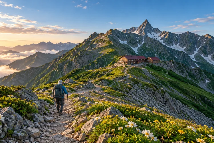
The Yarisawa approach avoids some of the exposed rocky ridges found on harder routes, although the final summit section is still steep and requires confidence on mountain terrain. A hut sits directly below the summit, making it possible to climb early in the morning when conditions are suitable.
The usual trekking window is roughly mid-July through early October because snow remains on the mountain for much of the year.
For hikers moving beyond day hikes but not yet ready for highly exposed traverses, Yarigatake is an excellent progression.
Build a Longer Ridge Journey Around Chogatake and Jonen
Not every memorable Northern Alps trek needs to target the most intimidating summits.
From Tokusawa or Yokoo, hikers can climb toward Chogatake and continue along the ridge toward Mt. Jonen. Kamikochi’s official trekking guide notes that this route provides broad views toward Yarigatake and the Hotaka range.
Sections of this network connect with the longer Omote Ginza trekking route.
A multi-day itinerary can link peaks such as Chogatake, Jonen, and Tsubakuro before eventually descending toward another trailhead rather than returning to the original starting point.
This makes route design much more interesting.
Instead of hiking up and down the same valley, you can create a point-to-point trek that combines ridgelines, mountain huts, and different access towns.
Water planning matters, though. The official Kamikochi guide warns that some ridge sections have no natural water sources between the lower valley and mountain huts.
Use Karasawa as a Base for the Hotaka Range
Karasawa offers one of the most dramatic amphitheater-like landscapes in the Northern Alps.
It sits beneath the Hotaka peaks and can be reached from Kamikochi through Myojin, Tokusawa, and Yokoo. Even without continuing onto technical summits, spending a night around Karasawa gives you a genuine high-mountain experience.
For stronger climbers, the area becomes a launch point toward peaks such as Oku-Hotakadake.
Oku-Hotakadake reaches 3,190 meters, making it the highest summit in the Northern Alps.
The terrain becomes considerably more serious above the valley. Rocky ridges, ladders, chains, steep drops, and rapidly changing weather mean this is not the place to underestimate Japanese mountain routes simply because huts are available.
Mountain huts reduce logistical difficulty. They do not remove alpine risk.
Leave the Dai-Kiretto for Experienced Mountaineers
One of the most famous traverses in the region connects the Yarigatake and Hotaka systems through the Dai-Kiretto.
It is also one of the routes where experience matters most.
Kamikochi’s official trekking information warns that the section between Oku-Hotakadake and Yarigatake can be dangerous even in good weather, with exposed rock, cliffs, and serious fall hazards.
JNTO gives a similar warning for the longer Tateyama-to-Kamikochi journey, describing the Dai-Kiretto section as genuinely dangerous and unsuitable for beginners.
If exposed scrambling, chains, ladders, and long high-altitude days are new to you, choose another route.
An advanced itinerary does not become better simply because it includes the hardest ridge available. Good mountain planning means matching the route to your actual abilities, not the itinerary you wish you were ready for.
Explore Tateyama for a Different Northern Alps Experience
Tateyama provides another excellent entry point into the range.
The Tateyama Kurobe Alpine Route crosses 37.2 kilometers of high mountain terrain between Toyama and Nagano, with Murodo sitting high in the mountains and providing access to numerous trekking routes.
Murodo makes high-altitude terrain unusually accessible because cable cars, buses, and ropeways handle much of the initial elevation gain.
That does not mean the trekking beyond it is easy.
JNTO outlines a demanding multi-day route beginning at Murodo and continuing through Goshikigahara, Yakushidake, Kurobegoro, Yarigatake, Hotaka, and eventually Kamikochi. Individual days can require six to ten hours of mountain travel.
Completing the full traverse creates one of the great point-to-point mountain journeys in Japan.
Consider the Tateyama-to-Kamikochi Traverse
For experienced hikers with enough time, the long traverse linking Tateyama and Kamikochi provides a completely different scale of adventure.
JNTO’s sample itinerary takes roughly six days. It moves from Murodo toward Goshikigahara and Yakushidake, continues through Kurobegoro toward Yarigatake, and eventually reaches the Hotaka range before descending to Kamikochi.
This route links several of the Northern Alps’ most significant landscapes rather than treating each peak as an isolated climb.
It also demonstrates the value of Japan’s mountain-hut network.
Huts allow trekkers to travel without full expedition-style camping equipment, but advance planning is still essential. Opening periods vary, water can be limited on ridges, and bad weather can completely change how realistic the next stage becomes.
The ideal high-alpine window is generally mid-July to early October. Earlier conditions may include significant remaining snow, while some huts may not yet be operating.
Treat Mountain Huts as Part of the Route Strategy
Japan’s mountain huts are not simply emergency shelters.
They are central to multi-day route planning.
Many provide sleeping space, meals, drinking water, and basic supplies, allowing trekkers to travel relatively light compared with a fully self-supported expedition.
Still, never assume that every hut will be open or have unlimited capacity.
Plan the overnight sequence before leaving the lowlands, check current operating dates, and understand how long each stage should take. On exposed ridges, arriving late in the afternoon can leave very little margin if weather deteriorates.
Tateyama’s official guidance also stresses that water at ridge huts can be precious because some supplies depend heavily on collected rainwater.
Responsible hut use is part of mountain etiquette, not just convenience.
Plan Around Japan’s Short Alpine Season
Timing is one of the biggest challenges of Northern Alps trekking.
Kamikochi itself is generally accessible from around mid-April to mid-November, but that does not mean major peaks are snow-free throughout that period.
For non-winter mountaineers, July through early October is the safer planning window for long high-level routes. JNTO notes that snow on ridges has generally melted substantially by August, while earlier-season climbing can require crampons, ice axes, and winter skills.
Autumn adds another issue: shorter daylight.
A six-hour summer day can become a more demanding proposition when daylight disappears earlier and temperatures drop quickly after sunset.
Check current forecasts before each stage and be willing to alter the route.
Mountains do not care how expensive your hut reservation was.
Carry Less, but Prepare More Carefully
Hut-based trekking allows a lighter backpack, but preparation should still be serious.
Rain gear, warm layers, gloves, navigation tools, water, emergency food, a headlamp, and suitable footwear belong in your pack even when the forecast looks good.
Japanese alpine terrain can shift from warm valley conditions to wind, fog, and low temperatures within hours.
Submitting a hiking plan is also encouraged in the Tateyama area, and hikers are asked to remain on designated trails and camp only in approved places.
Do not let the excellent trail infrastructure create false confidence.
Mountain huts, signs, and transport systems make the Northern Alps accessible. The terrain itself remains alpine.
Careful preperation is what lets you enjoy that accessibility safely.
Build Recovery Time Into a Multi-Day Trip
One overlooked part of advanced trekking is what happens after the trail ends.
A five-day traverse followed immediately by an early train and international flight is not especially appealing. Leave at least one slower day after a demanding route.
Matsumoto works well after a Kamikochi trek, while Toyama provides a convenient recovery point after Tateyama.
Hot springs can also become part of the itinerary rather than an afterthought.
The bigger lesson is simple: do not schedule every day around vertical gain.
Mountain journeys feel better when the itinerary includes time to eat properly, dry equipment, recover tired legs, and process where you have just been.
Exploring Japan’s Northern Alps through multi-day mountain routes reveals a side of the country that feels far removed from its cities and railways.
Kamikochi provides access to Yarigatake, Karasawa, Chogatake, Jonen, and the Hotaka range, while Tateyama opens longer traverses across the heart of the mountains.
The range offers everything from manageable hut-to-hut journeys to exposed expert-level ridges such as the Dai-Kiretto.
Choose difficulty carefully, plan mountain huts before departure, and treat July through early October as the core season for non-winter high-altitude trekking. Most importantly, leave space for weather to change your plans.
Pick one route that matches your experience, give it several days, and experience the Northern Alps as a journey rather than another summit to collect.