Uzbekistan is one of those places where the Silk Road does not feel like a chapter locked inside a history book.
Walk through an old quarter in Bukhara, stand beneath the enormous tiled facades of Samarkand, or enter the mud-brick walls of Khiva, and traces of centuries of trade are still surprisingly easy to spot.
Learning how to trace Silk Road heritage through Uzbekistan’s old towns means looking beyond famous landmarks.
The real story is hidden in street patterns, bazaars, caravanserais, religious schools, city gates, workshops, and even the distances between one oasis settlement and another.
The Silk Roads themselves were not a single highway. They were interconnected routes that carried merchants, pilgrims, diplomats, scholars, technologies, beliefs, and goods across Eurasia.
UNESCO describes Silk Road cities as crucial places where travellers could rest, trade, and exchange skills and ideas.
Uzbekistan is especially rewarding because several of its historic cities preserve different layers of that enormous network.
Start With Samarkand’s Layers, Not Just Registan Square
Samarkand is often the first place travellers associate with the Silk Road, and Registan Square usually receives most of the attention. Its monumental madrasas certainly deserve time, but understanding Samarkand requires looking beyond the postcard view.
The city has more than 2,500 years of history. Ancient Samarkand developed around Afrasiab, while its most famous architectural transformation occurred during the Timurid period in the 14th and 15th centuries. UNESCO describes the city as a crossroads and melting pot of world cultures.
A useful way to trace that history is to move between different historical zones. Visit the Afrasiab archaeological area, then continue toward Shah-i-Zinda, Bibi-Khanum Mosque, Registan, and Gur-e Amir.
Doing this reveals something that photographs cannot: Samarkand developed in layers. Different periods of the city grew beside one another rather than simply replacing everything that came before.
That makes Samarkand less like a single historic center and more like a timeline you can physically walk through.
Read Bukhara Like a Medieval Trading City
If Samarkand impresses through scale, Bukhara explains how a Silk Road city actually functioned.
Bukhara is more than 2,000 years old, and UNESCO considers its historic center one of Central Asia’s best-preserved examples of a medieval Islamic city.
Its urban fabric has remained largely intact, which makes it especially useful for understanding how commerce, religion, education, and daily life once overlapped.
Instead of rushing from one monument to another, pay attention to how buildings relate to each other.
Mosques sit near trading spaces. Madrasas appear beside busy streets. Covered bazaars connect different commercial zones, while narrow residential lanes spread outward into quieter neigbourhoods.
Sites such as the Poi-Kalyan complex, Lyabi-Hauz, the Ark, and trading domes receive plenty of attention, but the spaces between them are equally valuable.
The city’s layout reminds visitors that Silk Road commerce depended on urban infrastructure. Merchants needed accommodation, warehouses, craftsmen, money changers, food markets, places of worship, and networks of local contacts.
Look for Caravanserais, Trading Domes, and Market Spaces
Silk Road heritage becomes easier to understand once you stop searching only for palaces and mosques.
Commercial buildings can often tell you more about trade than royal monuments do.
Caravanserais were essentially roadside or urban facilities where merchants could stay with their goods and animals. Depending on the location and period, they could provide storage, accommodation, security, and opportunities to meet other traders.
Bukhara’s commercial landscape also included covered trading domes. These structures created protected areas where merchants and artisans could sell goods away from intense summer heat or winter weather.
In Khiva, UNESCO’s description of Itchan Kala specifically notes the presence of caravanserais and markets alongside mosques, madrasas, mausoleums, and homes.
When exploring these spaces today, look at entrances, courtyards, storage areas, and proximity to main streets. The architecure often reveals how goods and people were expected to circulate.
Explore Khiva as a Walled Caravan City
Khiva feels very different from Samarkand and Bukhara.
Its historic inner city, Itchan Kala, is enclosed by impressive brick fortifications and covers about 26 hectares. UNESCO records 51 historic monumental structures and around 250 traditional dwellings within the protected area.
More importantly for Silk Road history, Khiva occupied a strategic position in Khorezm, south of the Amu Darya River. Itchan Kala served as a final major resting place for caravans preparing to cross desert routes toward Persia.
That geographic role helps explain the city’s fortified character.
Walking through Khiva’s gates and narrow streets, try imagining the practical concerns facing a caravan arriving after days of travel: finding water, securing valuable merchandise, feeding animals, repairing equipment, negotiating prices, and gathering information about the journey ahead.
Khiva’s compact layout makes those connections particularly easy to visualize. Rather than isolated monuments, the entire old town can be read as an interconnected commercial and residential environment.
Follow the Silk Road Beyond the Three Famous Cities
Samarkand, Bukhara, and Khiva dominate most Uzbekistan itineraries, but stopping there can create an incomplete picture.
Shahrisabz, south of Samarkand, adds another important historical layer.
The city is more than 2,000 years old and stood on Silk Road routes through southern Uzbekistan. It became especially important during the era of Amir Temur and the Timurids, with monuments including the remains of Ak-Sarai Palace and several religious complexes.
Historic sources also describe caravanserais, bazaars, baths, defensive structures, and traditional houses as part of its urban environment.
Visiting smaller cities and archelogical sites helps reveal that trade did not simply jump from one famous capital to another.
The network depended on dozens of smaller settlements, forts, river crossings, agricultural areas, workshops, and stopping points that supplied larger trading centers.
Use Geography to Understand Why the Cities Existed
One of the best ways to understand Uzbekistan’s Silk Road heritage is simply to look at a map.
Historic merchants could not travel wherever they wanted. Water, mountains, deserts, rivers, seasonal weather, and safe stopping points shaped every route.
The UNESCO-listed Zarafshan-Karakum Corridor demonstrates this clearly. Stretching roughly 866 kilometers through Tajikistan, Uzbekistan, and Turkmenistan, the corridor followed the Zarafshan River before continuing toward desert routes leading to the Merv Oasis.
It channelled trade and cultural exchange for centuries, from around the 2nd century BCE to the 16th century CE.
This geographic perspective changes how you see Samarkand and Bukhara.
They were not prosperous simply because impressive rulers chose to build there. Their locations connected fertile valleys, oasis systems, desert crossings, and routes leading toward Persia, China, the steppe, and other parts of Central Asia.
Once you understand the landscape, the old cities begin to make much more sense.
Watch for Craft Traditions and Cultural Exchange
The Silk Roads carried much more than silk.
Merchants transported textiles, ceramics, horses, metals, spices, paper, precious stones, and numerous other commodities. Yet material goods were only part of the story.
Travelling communities also carried languages, religious beliefs, scientific ideas, artistic techniques, architectural styles, and manufacturing knowledge.
UNESCO emphasizes that Silk Road cities became centers of intellectual and cultural exchange partly because merchants, teachers, scholars, and religious figures regularly encountered one another there.
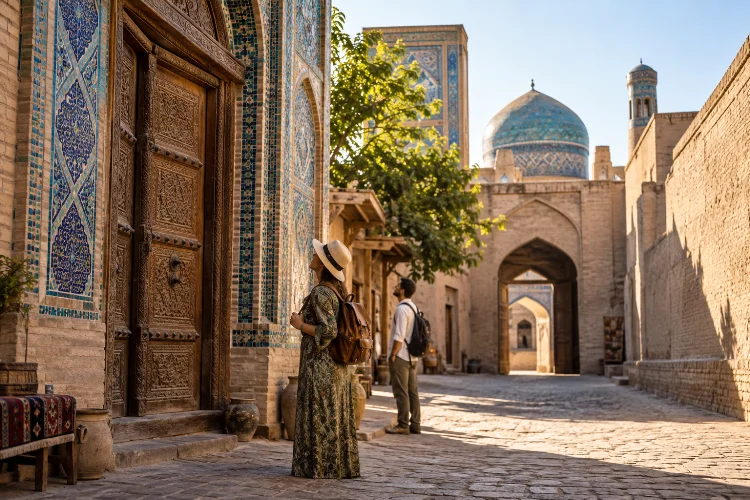
Look closely at tilework, carved wooden doors, ceramics, metal objects, textiles, and traditonal workshops while travelling through Uzbekistan.
These crafts should not automatically be treated as unchanged survivals from medieval times, but they can help visitors understand how artisan knowledge became an important part of urban culture.
Museums are particularly useful here because they provide historical context for objects that otherwise risk becoming simple souvenirs.
Slow Down and Explore on Foot
Tracing Silk Road history works best when you give yourself time.
In Bukhara and Khiva especially, walking allows you to notice features that disappear when moving quickly between attractions.
Small courtyards, old doors, side streets, workshops, neighborhood mosques, and sections of defensive walls can tell a richer story than the most photographed monuments.
Early morning and late afternoon are particularly good times to wander. Streets tend to feel calmer, architectural details are easier to notice, and you can better understand the scale of the historic environment.
Consider using a local guide for at least one old town, but ask specifically about trade networks, crafts, water systems, city planning, and everyday life rather than requesting only a list of dates.
The goal is not simply to see Silk Road landmarks. It is to understand why these cities worked.
Connect the Cities Into One Historical Journey
A good Uzbekistan Silk Road itinerary becomes much more meaningful when each destination answers a different question.
Samarkand can show how imperial power transformed a major cultural crossroads. Bukhara reveals the relationship between trade, scholarship, religion, and urban life.
Khiva illustrates the challenges of caravan travel near desert routes, while Shahrisabz adds another layer of Timurid and regional history.
Viewed together, these old towns demonstrate why there was never just one Silk Road.
The network constantly changed as political powers shifted, cities expanded, routes became safer or more dangerous, and commercial priorities evolved.
That complexity is precisely what makes travelling through Uzbekistan so rewarding.
Tracing Silk Road heritage through Uzbekistan’s old towns is about more than photographing blue domes and ancient walls.
The deeper story appears when you connect monuments with bazaars, caravanserais, residential streets, crafts, geography, and the routes that once linked each settlement.
Samarkand shows the scale of cultural exchange, Bukhara preserves the feel of a medieval trading city, Khiva reveals the importance of desert caravan infrastructure, and Shahrisabz adds another perspective on regional power and movement.
So when planning an Uzbekistan journey, leave space between the major attractions. Walk through old streets, visit museums, examine market architecture, and look at the landscape between cities.
That is where the Silk Road stops being an abstract historical idea and starts becoming a journey you can actually trace.